
Archaeologists have turned to modern geophysical technology to investigate one of Ujjain’s most intriguing archaeological sites. At Vaishya Tekri in Madhya Pradesh, a joint team involving the Archaeological Survey of India (ASI), the state archaeology department and Maulana Azad National Institute of Technology (MANIT) has conducted a ground-penetrating radar (GPR) survey to examine what may lie beneath the mound.
The investigation marks an important step towards understanding a site that attracted archaeological attention during excavations in 1938–39. Those early investigations were interrupted following a reported incident in which several workers lost consciousness, reportedly because of a gas leak. Nearly nine decades later, non-invasive technology is helping researchers investigate the site before deciding where further archaeological work may be appropriate.
However, an important distinction remains: the GPR survey is an investigation, not confirmation of a newly discovered buried structure. Its findings must be interpreted and, where appropriate, verified through further archaeological research.
Where Is Vaishya Tekri?
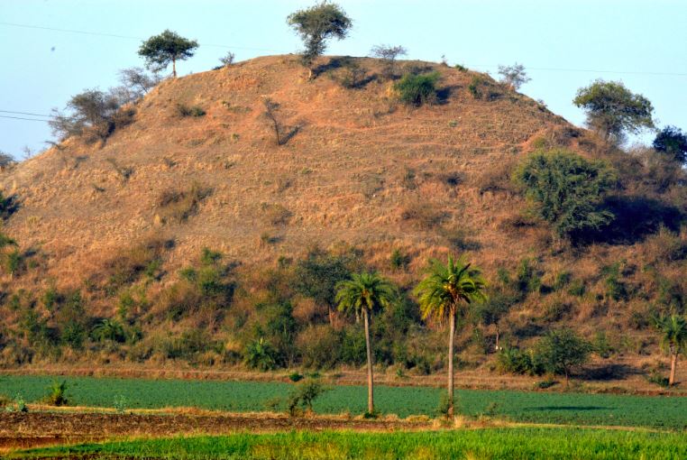
Vaishya Tekri is an archaeological mound near Ujjain, in Madhya Pradesh. Ujjain, known in ancient sources as Ujjayini, was an important urban, political and commercial centre in the historic region of Avanti.
The mound has attracted particular interest because earlier archaeologists interpreted it as a potentially significant Buddhist stupa. Historical excavation reports describe a massive structure, with estimates placing its base at approximately 350 feet in diameter and its height at around 100 feet or more.
These dimensions have often been compared with the Great Stupa at Sanchi, although comparisons of size alone cannot establish a monument’s date, identity or historical significance.
The site’s association with the Mauryan period and Emperor Ashoka remains an important historical question requiring careful examination of archaeological evidence.
What Is Ground-Penetrating Radar (GPR)?
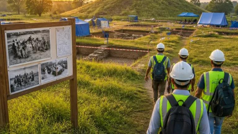
Ground-penetrating radar is a geophysical technique that allows researchers to investigate subsurface features without first removing the soil through excavation.
The equipment transmits electromagnetic pulses into the ground. When these waves encounter boundaries between materials with different electrical properties, some of the energy is reflected back to a receiving antenna.
Researchers record these returning signals and analyse them to construct profiles or maps of the ground beneath the survey area.
Depending on soil conditions, survey depth and the characteristics of the buried features, GPR may help identify anomalies associated with:
- Buried walls and masonry foundations
- Changes in soil composition or construction material
- Possible voids and cavities
- Buried deposits and other subsurface features
- Differences in the internal structure of an archaeological mound
These signals are not direct photographs of buried buildings. Archaeologists and geophysicists must interpret them in context, and further investigation may be necessary to determine what caused a particular anomaly.
Why Is the Vaishya Tekri Survey Important?
1. Investigating the mound without immediate excavation
Traditional archaeological excavation involves removing soil and deposits to expose structures and artefacts. Although excavation remains essential for answering many archaeological questions, it is also destructive in the sense that excavated layers cannot be restored to their original condition.
GPR offers a way to investigate selected areas before deciding whether excavation is necessary.
At Vaishya Tekri, this approach could help researchers develop a better understanding of the mound’s internal structure while limiting unnecessary disturbance.
2. Identifying areas for further archaeological investigation
A large mound may contain several construction phases, buried walls, altered deposits or natural geological features.
A geophysical survey can help identify areas that warrant closer examination. If the results reveal coherent anomalies, researchers may use them to guide future surveys or carefully planned excavation.
This makes GPR a useful preliminary tool rather than a substitute for excavation.
3. Understanding the possible layout of a buried monument
If the mound contains substantial architectural remains, mapping subsurface anomalies may help researchers investigate their extent, orientation and relationship to one another.
At Vaishya Tekri, this could contribute to a more detailed understanding of the monument’s construction and any associated features.
Such interpretations must await the analysis of the survey data. The presence, nature and date of any buried structures cannot be established from the use of GPR alone.
Vaishya Tekri: What Happened During the 1938–39 Excavations?
Vaishya Tekri was investigated in 1938–39 by the archaeology department of the erstwhile Gwalior State.
The excavation report described a huge stupa-like structure with an unusually massive core. Accounts of the earlier work also mention large bricks and punch-marked coins, finds that contributed to interpretations of the site’s antiquity.
The excavation was not completed. Historical and contemporary news reports recount an incident during which workers reportedly lost consciousness after a suspected gas leak, following which the work was stopped.
The precise circumstances of the reported incident should be distinguished from what the archaeological evidence establishes about the monument itself. The interruption left important questions about the mound’s construction and history unresolved.
The recent use of GPR represents a different investigative approach: researchers can first examine the subsurface and assess the results before determining the next steps.
The possible connection between Vaishya Tekri and the Mauryan period has generated considerable interest, particularly because of Ujjain’s historical associations with Ashoka.
However, identifying the mound definitively as an Ashokan monument requires evidence that supports that attribution.
The site’s enormous size and its interpretation as a stupa are significant starting points, but neither independently proves that Ashoka commissioned its construction. Archaeologists must consider the construction techniques, datable materials, stratigraphy, associated artefacts and any relevant inscriptions or historical evidence.
The recent survey may help researchers formulate more precise questions about the mound. Whether it can establish new evidence for the monument’s date or function will depend on the survey results and subsequent investigations.
What Do We Know So Far?
The reported GPR survey is an important development in the renewed investigation of Vaishya Tekri. However, the distinction between the work completed and the questions still awaiting answers is essential.
What is established:
- A GPR survey has been conducted at Vaishya Tekri by a team involving ASI, the Madhya Pradesh state archaeology department and MANIT.
- The survey aims to map subsurface features without relying immediately on excavation.
- The mound had previously been investigated during the 1938–39 archaeological season.
- Its interpretation as a major ancient stupa makes further investigation historically significant.
What remains uncertain:
- The exact nature and extent of any subsurface anomalies identified by the survey.
- Whether those anomalies correspond to buried architectural structures.
- Whether additional excavation will be undertaken and what it may reveal.
- The monument’s precise date, construction history and relationship to Ashoka.
Until the technical results are interpreted and made available, claims of newly discovered chambers, walls or other structures would be premature
Why Modern Archaeological Technology Matters
Archaeology increasingly combines traditional excavation with scientific techniques such as ground-penetrating radar, electrical resistivity surveys, magnetometry and remote sensing.
Each method has different strengths and limitations. GPR can be especially useful for examining changes beneath the ground surface, although its effectiveness depends on soil moisture, conductivity, material composition, survey settings and the depth of the features being investigated.
At a site such as Vaishya Tekri, these methods can help researchers plan investigations more strategically and reduce unnecessary disturbance to potentially important archaeological deposits.
The value of the technology lies not in producing dramatic discoveries on demand, but in generating evidence that can be tested against archaeological observations.
Conclusion
The ground-penetrating radar survey at Vaishya Tekri represents a renewed scientific effort to investigate an important archaeological mound near Ujjain. After the interruption of earlier excavations nearly nine decades ago, modern geophysical methods offer researchers another way to examine its subsurface structure.
The survey may help guide future archaeological work and improve understanding of the site. Yet its most significant results will emerge only through careful analysis, corroboration and, if warranted, further investigation.
For now, Vaishya Tekri remains a site of considerable archaeological interest—and the questions surrounding its construction, chronology and historical associations remain open.
At The Indian Archaeology, we follow discoveries through evidence rather than speculation. The next stage of research at Vaishya Tekri may help clarify what lies beneath this remarkable mound.
References and Further Reading
- The Times of India — ASI Conducts GPR Survey to Revive Study of Ujjain’s Vaishya Tekri Stupa
https://timesofindia.indiatimes.com/city/bhopal/asi-conducts-gpr-survey-to-revive-study-of-ujjains-vaishya-tekri-stupa/articleshow/134847777.cms - The Indian Express — Tracing Ashoka in Ujjain: What fresh dig at Vaishya Tekri ‘stupa’ can and cannot reveal
https://indianexpress.com/article/explained/explained-history/ashoka-ujjain-fresh-dig-vaishya-tekri-stupa-10842043/ - Archaeological Survey of India / Government of India archaeological publication — Ancient India, discussion of Vaishya Tekri and the suspected stupa
https://nmma.nic.in/nmma/NAS1/nmma_doc/AI/Ancient%20India%209.pdf
Editorial note: The identification of Vaishya Tekri as an Ashokan-period monument should be treated as an interpretation requiring further evidence, not as a conclusion established by the GPR survey.